By the President of the United States of America
A Proclamation
Whereas section 1 of Public Law 257, 80th Congress, approved July 30, 1947, provides that "for the purpose of providing breeding places for game animals and birds and for the protection and administration of game animals and birds, and fish, the President of the United States is hereby authorized, upon the recommendation of the Secretary of Agriculture, to establish by public proclamation certain specified federally owned areas within the Francis Marion National Forest as game sanctuaries and refuges"; and
Whereas the Secretary of Agriculture has recommended that the lands owned by the United States within the area hereinafter described be established as a game sanctuary and refuge; and
Whereas it appears that the establishment of such sanctuary and refuge would be in the public interest:
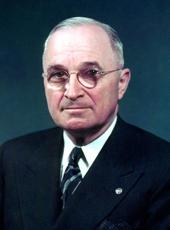
Now, Therefore, I, Harry S. Truman, President of the United States of America, under and by virtue of the authority vested in me by the aforesaid act of July 30, 1947, do proclaim that for the purpose of providing breeding places for game animals and birds and for the protection and administration of game animals and birds, and fish, all of the lands owned by the United States in the following-described area within the Francis Marion National Forest, in the State of South Carolina, are hereby established as a game sanctuary and refuge, to be known as the Francis Marion national Forest Wildlife Preserve:
Beginning at the point of confluence of Wambaw Creek and the South Santee River, in the Berkeley and Charleston County Line, latitude 33°12'47" N., longitude 79°26'49" W., thence southwesterly, up and with the meanders of Wambaw Creek, bordering U.S. Tract 113n, and on the Charleston-Berkeley County line, 156.0 chains to Forest Service monument 708;l thence four lines with U.S. Tract 70: (1) southeasterly with Echaw Road, 75.0 chains to Forest Service monument 717, (2) southwesterly with Old Stage Coach Road, 69.0 chains to Forest Service monument 706, (3) S. 45°45' W., 114.30 chains to a point, (4) S. 73°45' W., 3.50 chains to Forest Service monument 684; thence with U.S. Tracts13aa and 48, southeasterly 73.0 chains to Old Georgetown Road; thence with Old Georgetown Road, southwesterly 81.0 chains to line corners 2-3 of U.S. Tract 48; thence N. 30°00' W., 23.3 chains to Forest Service monument 683; thence southerly, with the east lines of U.S. Tract 113o, 61.3 chains to corner 34 thereof; thence southeasterly, with the NE lines of U.S. Tract 13z, 57.3 chains to Forest Service monument 682-1; thence with east and southeast lines of U.S. Tract 113o, passing in line corners 2 to 9 thereof, 158.5 chains to Forest Service monument 671; thence with northeast and southeast lines of U.S. Tract 49, passing in line corners 23 to 27 thereof, 119.2 chains to Forest Service monument 577; thence southwesterly, within U.S. Tract 49 and with Old Georgetown Road, 85.0 chains to line corners 39 to 40 thereof; thence N. 34°50' W., 21.0 chains to corner 40 of U.S. Tract 49 and Forest Service monument 567; thence southwesterly with U.S. Tract 49, passing in line corners 41 to 44, inclusive, 274.1 chains to corner 45 thereof; thence with the NE and SE lines of U.S. Tract 243, passing in line corners 4 to 13, inclusive, 111.5 chains to Forest Service monument 544-1; thence with the SE and SW lines of U.S. Tract 189, passing corners 2 and 3 thereof, 24.1 chains to Forest Service monument 544; thence with lands of Stepney Cash Estate, S. 36°45' W., 3.1 chains to corner 1 of U.S. Tract 74; thence with the SE lines of U.S. Tracts 74 and 189a, 21.7 chains to corner 2 of U.S. Tract 225; thence within said U.S. Tract 225, S. 66°20' W., 32.5 chains to corner 18 of said Tract 225, common to corner 63 of U.S. Tract 1; thence southwesterly, with five lines of said Tract 1, passing in line corners 64 and 65 thereof, 112.0 chains to corner 66; thence within said Tract 1, S. 76°30' W., 19.0 chains to corner 69; thence two lines with U.S. Tract 1: (1) S. 85°09' W., 24.6 chains, (2) S. 77° 50' W., 14.0 chains to corner 70 thereof; thence within U.S. Tract 1, N. 68°45' W., 50.0 chains to corner 73, thereof; thence two lines with U.S. Tract 1: (1) N. 45°25' W., 14.3 chains to corner 74, (2) S. 0°40' E., 80.0 chains to corner 75; thence continue within U.S. Tract 1, S. 85°30' W., 38.5 chains to Forest Service monument 503; thence westerly with Willow Hall Road, also known as Forest Service Road No. 40, 249.0 chains to Cooter Creek; thence northwesterly, up and with Cooter Creek, 88.0 chains to Forest Service monument 450; thence with U.S. Tract 1, N. 32°45' W., 37.7 chains to corner 52, common to corner 47 of U.S. Tract 11; thence with U.S. Tract 11, N. 30°15' W., 11.5 chains to corner 48, common to corner 7 of U.S. Tract 6a; thence with U.S. Tract 6a, N. 69°25' W., 9.4 chains to corner 1, common to corner 3 of U.S. Tract 1h; thence with U.S. Tract 1h, N. 69°2' W., 12.3 chains to Halfway Creek Road, in the Charleston-Berkeley County Line; thence northeasterly with Halfway Creek Road, and along the Charleston-Berkeley County Line, 375.0 chains to corner 11 of U.S. Tract 11; thence two lines with U.S. Tract 11: (1) N. 45°45' E., 42.9 chains to corner 12 thereof, (2) N. 37°00' W., 15.8 chains to Halfway Creek Road; thence northeasterly with Halfway Creek Road, passing in line Forest Service monuments 484 and 602, 227.0 chains to junction with Thompson Branch Road; thence northeasterly with Halfway Creek Extension Road, 225.0 chains to junction with Coffee Road; thence southeasterly with Coffee Road, 20.0 chains to Honey hill Tower Road; thence easterly, with Honey Hill Tower Road and through U.S. Tract 3, 150.0 chains to line 22-23 of U.S. Tract 3; thence S. 44°45' E., along line 22-23 of U.S. Tract 3, 78.0 chains to corner 23 thereof, identical with Forest Service monument 653; thence two lines with U.S. Tract 3: (1) N. 45°30' E., 16.4 chains, (2) N. 39°40' E., 10.0 chains to corner 24 of U.S. Tract 3, identical with corner 9 of U.S. Tract 16; thence three lines with U.S. Tract 16: (1) N. 43°00' E., 6.2 chains, (2) N. 42°30' E., 18.8 chains, (3) N. 44°45' W., 85.0 chains to Waterhorn Fence; thence northeasterly with Waterhorn Fence and within lands of the United States, 460.0 chains to the South Santee River; thence southeasterly with lands of the United States and along the South Santee River, 710.0 chains to the point of beginning.
All persons are hereby informed that it is unlawful to hunt, catch, trap, willfully disturb, or kill any kind of game animals, game or nongame bird, or fish, or to take the eggs of any such bird, on any lands of the United States herein designated or in or on the waters thereof, except under such general rules and regulations as may be prescribed from time to time by the Secretary of Agriculture.
In Witness Whereof, I have hereunto set my hand and caused the seal of the United States to be affixed.
Done at the city of Washington this 10th day of May, in the year of our Lord nineteen hundred and forty-eight, and of the Independence of the United States of America the one hundred and seventy-second.

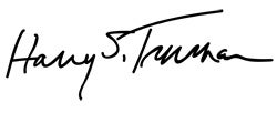
HARRY S. TRUMAN
By the President:
G. C. MARSHALL,
Secretary of State.
Harry S Truman, Proclamation 2785—Francis Marion National Forest Wildlife Preserve Online by Gerhard Peters and John T. Woolley, The American Presidency Project https://www.presidency.ucsb.edu/node/287241

