Section I. By virtue of the authority vested in me by law, section 1 of Executive Order No. 1898 of March 12, 1914, relating to the Canal Zone judiciary, as amended by Executive Order No. 3965 of February 26, 1924, is hereby amended to read as follows:
Section 1. The Balboa Division of the District Court of the Canal Zone, in conformity with the Panama Canal Act, shall include all that part of the Canal Zone which lies within the lines of the 10-mile zone and extends from the left bank of the Rio Chagres and the shore line of Gatun Lake, 87 feet above mean sea level, to the Pacific Ocean, and in addition thereto the following territory, now a part of the Canal Zone, shown on Panama Canal Drawing No. 6071-1 Revised, having a total area of approximately 26 square miles:
Beginning at 100-foot contour monument No. 37, which monument is a 4-inch galvanized iron pipe extending about 2 feet above the ground, the geographic position of which (referred to the Canal Zone triangulation system by stadia traverse) is in latitude 9° 12' plus 2,644.2 feet and longitude 79° 37' plus 4,793.4 feet, said monument being on the right bank of the Rio Chagres and the left bank of the Quebrada Madronal near its mouth; thence following the 100-foot contour along the left bank of the Quebrada Madronal upstream to where the 100-foot contour crosses the Quebrada Madronal and intersects the right bank of the stream, at concrete monument No. 37½, in latitude 9° 12' plus 5,664.8 feet and longitude 79° 37' plus 4,005.5 feet; thence following the right bank of the Quebrada Madronal upstream to a concrete monument in latitude 9° 14' and longitude 79° 36' plus 5,262.7 feet; thence east a distance of 768.3 feet to 260-foot contour monument No. 164½ in latitude 9° 14' and longitude 79° 36' plus 4,494.4 feet; thence following the continuous 260-foot contour around and across the Rio Chagres and its tributaries, the Rio Pequeni and the Rio Boqueron, through the 260-foot contour monuments, numbered 164 to 20, to 260-foot contour monument No. 19½, at the intersection of the 260-foot contour with the left bank of the Rio Azote Caballo, in latitude 9° 10' plus 4,690.9 feet, and longitude 79° 34' plus 5,655.3 feet; thence N. 85° 30' 20" W. a distance of 3,559.8 feet, crossing the Rio Chilibrillo, to a concrete monument in latitude 9° 10' plus 4,969.8 feet and longitude 79° 35' plus 3,194.6 feet; thence N. 37° 46' E. a distance of 550.0 feet to a concrete monument on the left bank of the Rio Chilibrillo; thence following the left bank of the Rio Chilibrillo downstream to a concrete monument in latitude 9° 11' plus 1,142.1 feet and longitude 79° 36' plus 4,860.4 feet; thence S. 56° 06' W. a distance of 300.1 feet, crossing the Madden Road at its center-line station 549 plus 68.9 feet, to a concrete monument which is 137.5 feet from the center line of said Madden Road; thence paralleling the Madden Road, in a northerly direction and at a distance of 137.5 feet from the center line thereof, to a concrete monument in latitude 9° 11' plus 4,823.6 feet and longitude 79° 37' plus 194.8 feet; thence N. 75° 45' W. a distance of 1,547.1 feet to a concrete monument in the Quebrada Moja Polla; thence down the Quebrada Moja Polla to the crossing of the 100-foot contour at monument No. 33; thence following the 100-foot contour through monuments Nos. 34 and 35in a westerly, northerly, and easterly direction to a point on the left bank of the Rio Chagres, directly south of the point of beginning; thence due north across the Rio Chagres to the point of beginning;
and the Cristobal Division of said court shall include all of the territory within the lines of the 10-mile zone extending from the Balboa Division to the Atlantic Ocean, and the area of Gatun Lake beyond the lines of the 10-mile zone up to the contour line of 100 feet above mean sea level and the islands in said lake; and the peninsulas bordering on said lake which have been taken by the United States for the purposes of the Panama Canal, with the exception of the area along the Rio Chagres, upstream from the mouth of the Quebrada Madronal, which area is in the Balboa District. References to right or left banks of rivers relate to the location when facing downstream.
Section II. This order shall take effect and be in force from and after the date hereof.

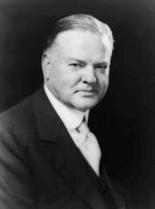
HERBERT HOOVER
The White House,
September 2, 1931.
Herbert Hoover, Executive Order 5704—Delimiting Canal Zone Judicial Districts Online by Gerhard Peters and John T. Woolley, The American Presidency Project https://www.presidency.ucsb.edu/node/361387

