Executive Order 5199—Restoring Certain Portions of Tongass National Forest, Alaska, for Entry Purposes
Under authority of the act of Congress approved June 4, 1897 (30 Stat. 34-36), and on the recommendation of the Secretary of Agriculture, it is hereby ordered that the tracts of land, in Alaska, lying within the following described boundaries, heretofore occupied as a homesite or for fish cannery purposes be, and the same are hereby, excluded from the Tongass National Forest and restored to entry under the applicable public land laws:
Beginning at Corner No. 1 on eastern shore of Tongass Island, approximately in latitude 54° 44' 59" N., longitude 130° 39' 51" W., a stake set on shore line at Corner No. 1 of Ranger Station survey, scribed HS MC 1; thence S. 6° W. 3.90 chains to Corner No. 2 a hemlock 16 inches in diameter, blazed four sides scribed HS 2 (old corner R. 2); thence N. 81° W., 9.32 chains to Corner No. 3, a hemlock blazed four sides scribed HS 3; thence N. 2° 30' E., 7.22 chains to Corner No. 4, a spruce stake 3 inches square set in ground and scribed MC HS 4; thence by meanders along shore line at average high tide to Corner No. 1, the place of beginning, containing approximately 4.84 acres;
Beginning at Corner No. 1, MC on Kuiu Island, approximately in latitude 56° 35' 30" N., longitude 134° 15' W., a slate rock in place marked with an X at line of mean high tide, and identical with Corner No. 4 of U. S. Survey No. 962; thence by meanders along shore of Bay of Pillars, at approximately high tide line, to Corner No. 2 MC, an X marked on a slate ledge in place at approximate mean high tide line; thence S. 14° 30' E. 7.78 chains to Corner No. 3, not established; thence N. 75° 30' E., 10.76 chains to Corner No. 4, not established, identical with Corner No. 3 of U. S. Survey No. 962; thence N. 14° 30' W., 6.39 chains to Corner No. 1 M. C., the place of beginning, containing approximately 11.23 acres;
Beginning at Corner No. 1 on the south shore of the West Arm of Choinondeley Sound on Prince of Wales Island in approximately latitude 55° 15' 15" N., longitude 132° 20' W., a flat rock embedded in mound of stone, chiseled T. M. M. C. 1; thence by meanders along shore at approximately mean high tide to Corner No. 2, a rock in place at average high tide line, chiseled T. M. M. C. 2-X; thence south 21.15 chains to Corner No. 3, not set; thence east 19.75 chains to Corner No. 4 not set; thence N. 18° E. 16.40 chains to Corner No. 1, the place of beginning, containing approximately 17.78 acres;
Beginning at Corner No. 1 on easterly shore of Boca de Quadra about 1J^ miles from the entrance to Badger Bay, chiseled T. M. 1 identical with a Forest Service monument in approximately latitude 55° 6' 30" N., longitude 130° 45' 29" W., a rock in place chiseled X FSM on west face at approximate mean high tide line; thence by meanders along line of approximate mean high tide to Corner No. 2, a rock in place chiseled X TM 2; thence east 8.00 chains to Corner No. 3, not set; thence south 19.50 chains to Corner No. 4, not set; thence west 7.40 chains to Corner No. 1, the place of beginning, containing approximately 13.31 acres.

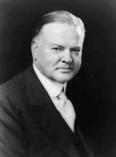
HERBERT HOOVER
The White House,
October 1, 1929.
Herbert Hoover, Executive Order 5199—Restoring Certain Portions of Tongass National Forest, Alaska, for Entry Purposes Online by Gerhard Peters and John T. Woolley, The American Presidency Project https://www.presidency.ucsb.edu/node/360897
