Whereas Executive orders dated November 16, 1874, and May 15, 1876, defined the southern boundary of the Colorado River Indian Reservation, in the State of Arizona, to be - -
"Beginning at a point where the La Paz Arroyo enters the Colorado River, 4 miles above Ehrenberg; thence easterly with said arroyo to a point south of the crest of La Paz Mountain;"
And whereas a survey of said southern boundary line made in 1876 erroneously located said southern boundary line by accepting an arroyo other than the Arroyo La Paz for said boundary line, which fact has been established to the satisfaction of the Interior Department by full investigations and hearings held for that purpose;
Now, therefore, in order to correct the error in locating said southern boundary line and in order to conform such line to the public system of surveys recently extended over these lands, it is hereby ordered that such southern boundary line of the Colorado River Indian Reservation shall be a line commencing at a point on the left bank of the Colorado River marked by an iron post 3 inches in diameter stamped C.R.I.R. on brass cap thereof as established by the United States surveyor in 1912; thence easterly along the line of iron posts established by said surveyor to the corner of townships 3 and 4 north, ranges 21 and 22 west, G. S.R.M.; thence north along the range line to the established corner of sections 13, 18, 19, and 24, township 4 north, ranges 21 and 22 west; thence easterly along the established section lines to the closing corner of sections 18 and 19, township 4 north, range 20 west, recorded by said United States surveyor as located north 6 degrees, 36 minutes east, 66.17 chains from an iron post marked C.R.I.R. on brass cap thereof, established on the highest point of La Paz Mountain.
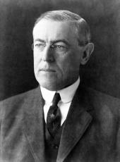
WOODROW WILSON
The White House,
November 22, 1915
Woodrow Wilson, Executive Order 2273—Colorado River Indian Reservation Online by Gerhard Peters and John T. Woolley, The American Presidency Project https://www.presidency.ucsb.edu/node/276612

