Executive Order 10666—Restoring Certain Land at Humuula, North Hilo, Hawaii, to the Possession, Use, and Control of the Territory of Hawaii
WHEREAS certain land situate at Humuula, North Hilo, Island and County of Hawaii, Territory of Hawaii, which forms a part of the public lands ceded and transferred to the United States by the Republic of Hawaii under the joint resolution of annexation of July 7, 1898, 30 Stat. 750, was set aside by the Governor of Hawaii by Executive Order No. 1440 of May 23, 1951, as a site for a V. H. F. Link Station under the control and management of the Civil Aeronautics Administration, pursuant to the request of the Civil Aeronautics Administration at Honolulu, Territory of Hawaii; and
WHEREAS the Civil Aeronautics Administration has signified that such land is no longer required for the above-mentioned purposes; and
WHEREAS it is deemed advisable and in the public interest that such land be restored to the possession, use, and control of the Territory of Hawaii:
NOW, THEREFORE, by virtue of the authority in me vested by section 91 of the act of April 30, 1900, 31 Stat. 141, 159, as amended by section 7 of the act of May 27, 1910, 36 Stat. 443, 447, it is ordered that all of the land previously set aside by the Governor of Hawaii by the said Executive Order No. 1440 for the above-mentioned purposes, and more particularly described hereinafter, be, and it is hereby, restored to the possession, use, and control of the Government of the Territory of Hawaii:
Being portion of the Government (Crown) Land of Humuula.
Humuula, North Hilo, Hawaii, T. H.
Beginning at a 3/4" iron pipe at the east corner of this lot, the coordinates of said point of beginning referred to Government Survey Triangulation Station "OMAOKOILI" being 46700.4 feet South and 14775.9 feet East, as shown on Government Survey Registered Map 1641, thence running by azimuths measured clockwise from True South:
1. 52° 31' 200.00 feet along Mauna Loa Forest and Game Reserve (Executive Order 1288) to a 2" iron pipe;
2. 142° 31' 200.00 feet along Mauna Loa Forest and Game Reserve (Executive Order 1288) to a %" iron pipe;
3. 232° 31' 200.00 feet along Mauna Loa Forest and Game Reserve (Executive Order 1288) to a 3/4" iron pipe;
4. 322° 31' 200.00 feet along Mauna Loa Forest and Game Reserve (Executive Order 1288) to the point of beginning, and containing an AREA OF 0.92 ACRE.
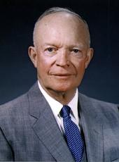
DWIGHT D. EISENHOWER
THE WHITE HOUSE,
April 27, 1956.
Dwight D. Eisenhower, Executive Order 10666—Restoring Certain Land at Humuula, North Hilo, Hawaii, to the Possession, Use, and Control of the Territory of Hawaii Online by Gerhard Peters and John T. Woolley, The American Presidency Project https://www.presidency.ucsb.edu/node/306834
