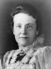
Dwight D. Eisenhower photo

Executive Order 10684—Including Certain Lands in the Cherokee National Forest

October 26, 1956

WHEREAS on July 26, 1955, the Tennessee Valley Authority and the United States Department of Agriculture entered into an agreement (Contract No. TV-14174-A) providing for the transfer by the said Authority to the said Department of the right of possession and all other right, title, and interest which the Authority might have in or to certain lands therein designated and described in Carter and Johnson Counties, Tennessee, so that such lands might be included in and reserved as a part of the Cherokee National Forest, in accordance with the terms and conditions of the said agreement and subject to the approval required by section 4 (k) (c) of the Tennessee Valley Authority Act of 1933, as amended by the act of July 18, 1941 (55 Stat. 599); and

WHEREAS on March 7, 1956, the said agreement between the Tennessee Valley Authority and the United States Department of Agriculture was approved by the Director of the Bureau of the Budget pursuant to the provisions of section 4 (k) (c) of the Tennessee Valley Authority Act of 1933, as amended, and of section 1 (h) of Executive Order No. 10530 1 of May 10, 1954; and

WHEREAS it appears that such lands are suitable for national-forest purposes and that the inclusion of such lands in the Cherokee National Forest would be in the public interest:

NOW, THEREFORE, by virtue of the authority vested in me by section 24 of the act of March 3, 1891, 26 Stat. 1103, and the act of June 4, 1897, 30 Stat. 34, 36 (16 U.S.C. 471, 473), and as President of the United States, and upon the recommendation of the Secretary of Agriculture, I hereby include in and reserve as part of the Cherokee National Forest the following-described lands, such inclusion and reservation to be in accordance with and subject to the terms and conditions of the said agreement of July 26, 1955, between the Tennessee Valley Authority and the United States Department of Agriculture;

Certain land lying in the First and Fourth Civil Districts of Carter County and in the Fifth and Tenth Civil Districts of Johnson County, State of Tennessee, on the shores of Watauga Lake, including certain islands lying in the said lake, which land is designated as Tracts Nos. 1, 2, 2A, 3, 8, 10, 11, 12, 13, 18, 19, 20, 21, 22, 23, 24, 25, 25A, 26, 27, 28, 29, 30, 35, 36, 36A, 36B, 36C, 37, 38, 39, 40, 41, 42, and 43, each numbered tract being described in detail as follows:

TRACT No. 1

A tract of land lying in the First Civil District of Carter County, State of Tennessee, on the north shores of Watauga Lake, approximately 1 mile upstream from Watauga Dam, and more particularly described as follows:

Beginning at a concrete monument (Coordinates: N. 729,695; E. 3,149,020) at the top of a ridge and in the US-TVA Purchase Boundary, the said monument being the most northerly corner of the tract herein described.

From the initial point,

With the US-TVA Purchase Boundary and the top of the ridge as it meanders approximately along the following bearings and distances: S. 83° 57' E. 152 feet, S. 57° 41' E. 1,040 feet, S. 89' 43' E. 624 feet, and S. 10° 32' E. 317 feet to a 10-inch pine tree;

Leaving the ridge,

S. 49° 29' E., approximately 300 feet to a point In the 1980-foot contour on the shore of Watauga Lake;

Leaving the US-TVA Purchase Boundary, With the said contour as it meanders in a general westerly direction;

1 3 CFR, 1954 Supp. Leaving the contour,

N. 58° E., approximately 140 feet to U. S. Forest Service Monument No. 92 (Coordinates: N. 727,274; E. 3,146,078) and a 10-inch black oak tree at a corner in the US-TVA Purchase Boundary;

With the US-TVA Purchase Boundary, N. 58° E., 270 feet;

N. 60° E., 1,118 feet to a locust post in a stone pile;

N. 45° 30' E., 1,590 feet to a stone pile;

N. 45° 08' E., 865 feet to the point of beginning.

The tract as described above contains 172 acres, more or less.

TRACT No. 2

A tract of land lying in the First Civil District of Carter County, State of Tennessee, on the north shores of Watauga Lake, approximately 2% miles upstream from Watauga Dam, and more particularly described as follows:

Beginning at a corner (Coordinates: N. 730,752; E. 3,153,636) in the US-TVA Purchase Boundary, said corner being N. 9° 11' W., approximately 90 feet from a point where the said purchase boundary crosses McNealy Branch.

From the initial point,

With the US-TVA Purchase Boundary,

N. 55° 27' E., 1,208 feet to U. S. Forest Service Monument No. 158;

S. 86° 52' E., approximately 1,950 feet, passing a 10-inch pine tree at 362 feet, to a point in the 1,980-foot contour on the west shore of an inlet of Watauga Lake;

Leaving the US-TVA Purchase Boundary.

With the 1,980-foot contour as it meanders In a southerly direction to the mouth of the Inlet and thence in a general westerly direction to a point in the US-TVA Purchase Boundary;

Leaving the contour and with the US-TVA Purchase Boundary,

N. 9° 11' W. approximately 1,270 feet to the point of beginning. The tract as described above contains 95 acres, more or less.

TRACT No. 2A

A tract of land lying In the First Civil District of Carter County, State of Tennessee, on the east shore of a small inlet on the north side of Watauga Lake, approximately 31/4 miles upstream from Watauga Dam, and more particularly described as follows:

Beginning at a locust post (Coordinates: N. 731.297; E. 3,157,223) at a corner in the US-TVA Purchase Boundary.

From the initial point,

With the US-TVA Purchase Boundary,

S. 35° 48' W., approximately 200 feet to a point in the 1,980-foot contour on the shore of an inlet of Watauga Lake;

Leaving the US-TVA Purchase Boundary;

With the 1,980-foot contour as it meanders in a general northwesterly direction to a point In the US-TVA Purchase Boundary:

Leaving the contour and with the US-TVA Purchase Boundary, 8.138° 52' E., approximately 350 feet to the point of beginning.

The tract as described above contains 0.9 acre, more or less.

TRACT No. 3

A tract of land lying in the First Civil District of Carter County, State of Tennessee, on the north shores of Watauga, Lake, approximately % mile northwest of the State Highway 67 bridge across the lake, the said tract being bounded on the lakeward side by the 1,975-foot contour and on the landward side by a line described as follows:

Beginning at a point on the 1,975-foot contour on the northwest shore of Watauga Lake at the mouth of the Site Branch Embayment of Watauga Lake and in the 1:78-TVA Purchase Boundary from which a 1O-inch red oak tree (Coordinates: N. 730,325; E. 8,158,355) at the top of a ridge bears N. 60' W., at a distance of approximately 65 feet.

From the initial point,

With the 1:78-TVA Purchase Boundary,

N. 60° W., approximately 86 feet to the said 10-inch red oak tree;

With the top of the ridge.

N. 19° W., 238 feet;

N. 15° W., 69 feet;

N. 29' W., 242 feet to an 8-inch poplar tree;

N. 9° E., 85 feet;

N. 10' E., 171 feet;

N. 5° W., 75 feet;

N. 18° W., 265 feet;

N. 47' W., 263 feet;

N. 53° W., 129 feet to an 8-inch red oak tree;

N. 42° W., 187 feet;

N. 22° W., 139 feet;

N. 44° W., 77 feet;

N. 21° W., 185 feet;

N. 8° W., 213 feet to a post at U. 8. F. 8. Corner No. R-13 (Coordinates: N. 732,372; E. 3,157,503);

Leaving the ridge,

N. 80° 30' E., 1,362 feet, crossing the 1,975-foot contour at approximately 910 feet and recrossing the said contour at approximately 970 feet, to U. 8. F. S. Corner No. R-1;

N. 27° 45' W., 644 feet to U. S. P. S. Corner No. R-2;

N. 8° 27' W., 391 feet to a post at II. S. F. S. Corner No. R-3;

8. 83° 53' E., 902 feet to a 40-inch oak tree at U.13. F. S. Corner No. R-4;

N. 4° 47' E., 384 feet to a 14-inch oak tree; 8. 27° 55' E., 152 feet;

S. 89° 48' E., 312 feet;

S. 33° 48' E., 153 feet;

S. 27° 22' E., 385 feet;

8. 40° 21' E., 122 feet;

S. 33° 52' E., 183 feet to an 18-inch oak tree (Coordinates: N. 732,764; E. 3,160,141);

8. 78° 35' E.. approximately 210 feet to a point in the 1,975-foot contour on the southwest shore of an embayment of the lake.

Except, therefrom, all land lying below the 1,980-foot contour.

The tract as described above contains 86 acres, more or less.

TRACT No. 8

A tract of land lying in the First Civil District of Carter County and in the Fifth Civil District of Johnson County, State of Tennessee. on the north shores of Watauga Lake immediately downstream from the mouth of the Roan Creek Embayment of the lake, and more particularly described as follows:

Beginning at a corner (Coordinates: N. 731,035; E. 3,164,893) in the 178-TVA Purchase Boundary.

From the initial point,

With the US-TVA Purchase Boundary, N. 63° 02' E., 368 feet to a stake;

N. 63° 16' E., 147 feet;

N. 82' 13' E., 550 feet, passing s. 16-inch wild cherry tree at 275 feet, to a stake;

N. 61° 58' E., 245 feet to a 6-inch double dogwood tree; 8. 48° 28' E., 897 feet to a point in the southeast right-of-way line of State Highway No. 87;

With the said right-of-way line and a line 75 feet southeast of and parallel to a 4 degree curve to the right on the center line of the highway in a northeasterly direction 166.2 feet;

With a line radial to the said 4 degree curve S. 68° 41' E., 125 feet;

With a line 200 feet southeast of and parallel to the said 4 degree curve in a northeasterly direction 301.9 feet;

With a line parallel to a 300-foot cubic spiral for the said 4 degree curve in a northeasterly direction 42.9 feet;

With a line radial to the said spiral N. 52° 51' W., 125 feet;

With a line 75 feet southeast of and parallel to the said spiral in a northeasterly direction 245.4 feet; N. 41° 21' E., 45.0 feet;

With a line 75 feet southeast of and parallel to a 300-foot cubic spiral for a 3 degree and 15 minute curve to the left on the center line of the highway in a northeasterly direction 306.4 feet;

With a line parallel to the said 3 degree and 15 minute curve in a northeasterly direction 16.3 feet;

With a line parallel to a 300-foot cubic spiral for the said 3 degree and 15 minute curve in a northeasterly direction 194.0 feet;

With a line radial to the said spiral 8. 58° 13' E., 25 feet;

With a line 100 feet southeast of and parallel to the said spiral in a northeasterly direction 112.7 feet; N. 31° 05' E., 8.4 feet:

With a line 100 feet southeast of and parallel to a 300-foot cubic spiral for a 1 degree and 30 minute curve to the right on the center line of the highway in a north-easterly direction 296.1 feet:

With a line parallel to the said 1 degree and 30 minute curve in a northeasterly direction 2.6 feet;

Leaving the right of way line,

8. 55° 31' E., 585 feet;

N. 40' 38' E., 307 feet to a 10-inch pine snag; N. 51° 45' E., 325 feet to a point (Coordinates: N. 732,745; E. 3,168,488);

S. 50° 40' E., 79 feet;

8. 35° 19' E., 685 feet;

N. 73° 55' E., 1,090 feet to a white oak snag; N. 8' 14' E., 583 feet to a 16-inch white oak tree;

N. 41° 34' E., 874 feet;

N. 0° 52' W., 66 feet;

N. 5° 35' E., 699 feet to a stone (Coordinates: N. 734,436; E. 3,170,672);

S. 89° 25' E., approximately 445 feet to a point in the 1,980-foot contour on the west shore of the Cobb Creek Embayment of the lake;

Leaving the US-TVA Purchase Boundary,

With the 1,980-foot contour as it meanders in a general southeasterly direction to the mouth of the embayment and thence in a general westerly direction and subsequently in a general northeasterly direction to a point in the US-TVA Purchase Boundary;

Leaving the contour and with the US-TVA Purchase Boundary,

S. 44° 42' E., approximately 10 feet;

8. 49° 38' E., 866 feet to a 20-inch chestnut tree;

N. 83° 59' E., 200 feet to the point of beginning.

The tract as described above contains 850 acres, more or less.

TRACT No. 10

A tract of land lying in the Fifth Civil District of Johnson County, State of Tennessee, on the northwest shores of the Sink Branch Embayment of Watauga Lake. approximately 3/4 mile west of the mouth of the Roan Creek embayment of the lake, and more particularly described as follows:

Beginning at a 6-inch maple tree (Coordinates: N. 733,425; E. 3,173,630) at the top of a ridge and at a corner in the US-TVA Purchase Boundary.

From the initial point,

With the US—TVA Purchase Boundary,

8. 83° 40' E., approximately 360 feet to a point in the 1,980-foot contour on the west shore of the Sink Branch Embayment of Watauga Lake;

Leaving the US-TVA Purchase Boundary, With the 1980-foot contour as it meanders

in a southwesterly direction to a point in the

US-TVA Purchase Boundary;

Leaving the contour and with the US-TVA Purchase Boundary,

N. 18° 50' W., approximately 25 feet to a dogwood tree;

N. 22° 58' E., 407 feet;

N. 20° 54' E., 135 feet;

N. 26° 57' E., 182 feet to a 10-inch red oak tree;

N. 26° 27' E., 213 feet;

N. 30° 33' E., 238 feet;

N. 38° 09' E., 126 feet to the point of beginning.

The tract as described above contains 7.1 acres, more or less.

TRACT No. 11

A tract of land lying in the Fifth Civil District of Johnson County, State of Tennessee, on the northwest shores of the Roan Creek Embayment of Watauga Lake between the mouth of the said embayment and Doe Creek, and being more particularly described as follows:

Beginning at a point (Coordinates: N. 743,684; E. 3,187,211) at the top of a ridge and at a corner in the US-TVA Purchase Boundary.

From the initial point,

With the US-TVA Purchase Boundary,

N. 0° 07' W., 1,170 feet, passing a 24-inch black oak tree at approximately 25 feet, to a 12-inch red oak snag;

Due west, 427 feet, passing an 18-inch white oak tree at approximately 340 feet;

N. 1° 15' W., 1,327 feet, passing a 24-inch white oak tree at approximately 75 feet, to a 12-inch oak snag;

N. 0' 24' E., 424 feet to a 10-inch red oak stump (Coordinates: N. 746,605; E. 3,186,756);

N. 82° 39' E., 788 feet to a 36-inch double chestnut stump;

N. 82° 34' E., 53 feet to a point at the top of a ridge;

With the top of the ridge as it meanders approximately along the following bearings and distances: N. 44° E. 250 feet, N. 75' IL 240 feet, N. 57° E. 135 feet, N. 80' E. 350 feet, N. 42° 24' E. 218 feet, N. 48° 21' E. 254 feet to a 24-inch chestnut oak tree, N. 75° 36' E. 382 feet to a fallen 36-inch double chestnut tree, 8. 80° 13' E. 29 feet, N. 79' 32' K. 463 feet, S. 85° 22' E. 87 feet, N. 80' 14' E. 430 feet, 8. 86° 25' E. 868 feet, 8. 82' 00' K. 187 feet, N. 89° 08' E. 66 feet, N. 74° 52' E. 214 feet, N. 62° 09' E. 180 feet, N. 56° 31' E. 478 feet, N. 81° 37' E. 99 feet, N. 62* 07' 8. 524 feet, N. 63° 40' E. 228 feet, N. 56° 49' E. 155 feet to a 10-inch maple tree, and N. 65° 49' E. 290 feet to a 28-inch hickory tree;

N. 53° 21' E., 307 feet to a 4-inch twin dogwood tree;

N. 42° 06' E., 74 feet;

N. 32° 02' E., approximately 510 feet to a point in the 1,980-foot contour on the southwest shore of the Doe Creek Embayment of the lake;

Leaving the US-TVA Purchase Boundary.

With the said contour as it meanders in a general southwesterly direction to a point in the US-TVA Purchase Boundary on the east shore of the Sink Branch Embayment of the lake;

Leaving the contour and with the US-TVA Purchase Boundary,

N. 50° 54' E., approximately 210 feet;

N. 77° 24' E., 330 feet to a stake;

S. 23° 06' E., 474 feet to a point (Coordinates: N. 733,160; E. 3,174,818);

N. 34° 31' E., 210 feet;

N. 48° 07' E., 169 feet;

N. 36° 18' E., 182 feet;

N. 28° 44' E., 331 feet;

N. 32° 03' E., 416 feet;

N. 18° 51' E., 133 feet;

N. 51° 35' E., 451 feet;

N. 39° 37' E., 317 feet;

N. 70° 34' E., 72 feet;

S. 88° 46' E., 187 feet;

N. 73° 56' E., 130 feet;

N. 44° 57' E., 699 feet;

S. 47° 55' E., 222 feet;

N. 37° 07' E., 1063 feet to a 20-inch hickory tree;

N. 20° 46' E., 31 feet to a red oak stump; N. 49° 30' E., 126 feet;

N. 44° 19' E., 356 feet;

N. 38° 37' E., 553 feet;

N. 24° 36' E., 183 feet;

N. 11° 20' E., 511 feet to a 24-inch black oak tree (Coordinates: N. 737,600; E. 3,178,706);

N. 65° 52' E., 591 feet to a chestnut snag; N. 33° 00' E., 207 feet to a post at the top of a ridge;

With the top of the ridge as it meanders approximately along the following bearings and distances: N. 27° 54' E. 917 feet to a b-inch chestnut snag, N. 31° 58' E. 963 feet, N. 51° 59' E. 757 feet, N. 59° 19' E. 684 feet to an 8-inch dogwood tree, N. 44° 20' E. 842 feet to a 12-inch chestnut oak tree, N. 55° 63' E. 711 feet to a stake, N. 53° 11' E. 1192 feet to a 6-inch black oak tree, and N. 51° 45' E. 638 feet to a point (Coordinates: N. 742,568; E. 3,184,114);

Leaving the top of the ridge.

S. 88' 56' E., 860 feet;

N. 2° 03' E., 288 feet to a point at the top of the ridge;

With the top of the ridge as it meanders approximately along the following bearings and distances: N. 76° 46' E. 258 feet, N. 53° 17' E. 520 feet, S. 88° 41' E. 479 feet to a point;

Leaving the top of the ridge,

S. 1° 21' W., 664 feet;

N. 67° 21' E., 1,349 feet;

N. 88° 21' E., 80 feet to a 16-inch oak tree; N. 86° 21' E., 453 feet;

N. 0° 21' E., 846 feet to an 18-inch black oak tree at the top of a ridge;

With the top of the ridge, as it meanders approximately along a bearing and distance of S. 69° 43' W., 711 feet, to the point of beginning.

The tract as described above contains 1,639 acres, more or less.

TRACT No. 12

A tract of land lying in the Fifth Civil District of Johnson County, State of Tennessee, on the northeast shores of the Doe Creek Embayment of Watauga Lake, approximately 11/2 miles southeast of Doeville, and more particularly described as follows:

Beginning at a point (Coordinates: N. 748,691; E. 3,194,165) in the northeast right of way line of a county road and in the US-TVA Purchase Boundary.

From the initial point,

With the US-TVA Purchase Boundary and the said right of way line, a line 50 feet northeast of and parallel to the center line of the county road, S. 50° 40' E., 624 feet;

With a line parallel to a 16 degree curve to the left on the center line of the county road in a southeasterly direction 60 feet; S. 61° 47' E., 117 feet;

With a line parallel to a 14 degree curve to the right on the said center line in a south-easterly direction 120 feet;

With a line radial to the curve on the center line, N. 430 13' E., 50 feet;

With a line 100 feet northeast of and parallel to the said center line S. 46° 47' E., 147 feet;

With a line at right angles to the center line, S. 43° 13' W., 20 feet;

With a line 80 feet northeast of and parallel to the said center line S. 46° 47' E., 197 feet;

With a line parallel to a 24 degree curve to the right on the said center line in a southerly direction 257 feet; S. 00 32' E., 70 feet;

With a line parallel to an 18 degree curve to the left on the said center line in a southerly direction 99 feet; S. 24° 25' E., 122 feet;

With a line parallel to an 8 degree curve to the right on the said center line in a southerly direction 77 feet; S. 18° 51' E., 306 feet;

With a line parallel to a 5 degree curve to the right on the said center line in a southerly direction 70 feet to a point in the north right-of-way line of another county road;

With a line 50 feet north of and parallel to the center line of the last said road N. 75° 60' E., 22 feet;

With a line parallel to a 5 degree curve to the left on the center line of the road in an easterly direction 437 feet;

Leaving the right-of-way line,

S. 27° 54' E., approximately 135 feet to a point in the 1,975-foot contour on the north-west shore of the Roan Creek Embayment of the lake;

Leaving the US-TVA Purchase Boundary,

With the 1,975-foot contour as it meanders in a southwesterly direction to the mouth of the Doe Creek Embayment of the lake and thence in a general northwesterly direction to a point in the US-TVA Purchase Boundary;

Leaving the contour and with the US-TVA Purchase Boundary,

N. 28° 37' E., apprcximately 110 feet to the point of beginning.

Except, therefrom, all land lying below the 1,980-foot contour elevation.

The tract as described above contains 5.7 acres, more or less.

TRACT No. 13

A tract of land lying in the Fifth Civil District of Johnson County, State of Tennessee, on the southeast shores of the Roan Creek Embayment of Watauga Lake, approximately 2 miles southeast of Doeville and more particularly described as follows:

Beginning at a point (Coordinates: N. 745,-791; E. 3,195,346) in the southeast right of way line of a county road and in the US-TVA Purchase Boundary.

From the initial point,

With the US-TVA Purchase Boundary,

N. 33* 03' W., approximately 220 feet to a point in the 1,980-foot contour on the south-east shore of the Roan Creek Embayment of Watauga Lake;

Leaving the US-TVA Purchase Boundary,

With the said contour as it meanders in a general northeasterly direction to a point in the US-TVA Purchase Boundary;

Leaving the contour and with the US-TVA Purchase Boundary,

S. 40° E., approximately 120 feet to a point in the southeast right of way line of a county road;

With the said right of way line and a line 50 feet south of and parallel to the center line of the county road, S. 83° 16' W., 72 feet;

With a line parallel to a 38 degree curve to the left on the center line in a southwesterly direction 70 feet;

S. 43° 26' W., 110 feet;

With a line parallel to a 38 degree curve to the right on the center line in a westerly direction 186 feet to a point in the southeast right of way line of another county road;

With a line 80 feet southeast of and parallel to a 16 degree curve to the right on the center line of the second county road in a south-westerly direction 214 feet;

S. 51° 06' W., 190 feet to the point of beginning.

The tract as described above contains 2.1 acres, more or less.

TRACT No. 18

A tract of land lying in the Tenth Civil District of Johnson County, State of Tennessee, on the southwest shore of Watauga Lake, approximately IA mile south of the mouth of Draught Creek, and more particularly described as follows:

Beginning at a corner (Coordinates: N. 721,452; E. 3,197,086) in the US-TVA Purchase Boundary.

From the initial point,

With the US-TVA Purchase Boundary,

N. 38° 14' W., approximately 230 feet to a point in the 1,980-foot contour on the shore of Watauga Lake;

Leaving the US-TVA Purchase Boundary,

With the said contour as it meanders in a general southeasterly direction to a point in the US-TVA Purchase Boundary;

Leaving the contour and with the US-TVA Purchase Boundary,

8. 57° 34' W., approximately 160 feet to the point of beginning.

The tract as described above contains 0.8 acre, more or less.

TRACT No. 19

A tract of land lying in the Tenth Civil District of Johnson County, State of Tennessee, on the southwest shore of Watauga Lake, approximately IA mile south of the mouth of the Big Dry Run Embayment of the lake, and more particularly described as follows:

Beginning at a point (Coordinates: N. 724,626; E. 3,193,362) in the south right of way line of a county road and in the US-TVA Purchase Boundary.

From the initial point,

With the US-TVA Purchase Boundary,

N. 14° 16' E., approximately 210 feet to a point in the 1980-foot contour on the shore of Watauga Lake;

Leaving the US-TVA Purchase Boundary,

With the said contour as it meanders in a southeasterly direction to a point in the US-TVA Purchase Boundary;

Leaving the contour and with the US-TVA Purchase Boundary,

S. 51° 31' W., approximately 310 feet to a point in the northwest right of way line of a county road;

With the said right of way line and a line 50 feet northwest of and parallel to the center line of the county road N. 32° 39' E., 70 feet;

With a line parallel to a 36 degree curve to the left on the center line in a northerly direction 140 feet;

N. 40° 55' W., 218 feet to a point in the south right of way line of a second county road;

With the said south right of way line, a line 50 feet south of and parallel to a 20 degree curve to the right on the center line of the said second road, in a westerly direction 173 feet to a point;

N. 83° 12' W., 86 feet to the point of beginning.

The tract as described above contains 2.5 acres, more or less.

TRACT No. 20

A tract of land lying in the Tenth Civil District of Johnson County, State of Tennessee, on the south shores of Watauga Lake, approximately 1 mile upstream from the mouth of the Elk River Arm of the lake, and more particularly described as follows:

Beginning at a corner (Coordinates: N. 719,823; E. 3,185,435) in the US-TVA Purchase Boundary.

From the initial point,

With the US-TVA Purchase Boundary. S. 72° 35' W., 484 feet;

N. 79° 40' W., 357 feet to a point in the 1,980-foot contour on the south shore of Watauga Lake;

Leaving the US-TVA Purchase Boundary,

With the 1,980-foot contour as it meanders in an easterly direction to the mouth of a small inlet and thence in a southerly direction to a point in the US-TVA Purchase Boundary;

Leaving the contour and with the US-TVA Purchase Boundary,

N. 85° 42' W., approximately 20 feet; N. 13° 05' W., 758 feet;

N. 10° 43' W., 188 feet;

N. 9° 14' E., 125 feet to the point of beginning.

The tract as described above contains 0.3 acre, more or less.

TRACT No. 21

A tract of land lying in the Fifth Civil District of Johnson County, State of Tennessee, on the southwest shores of Watauga Lake, approximately 3/8 mile upstream from the mouth of the Elk River Arm of the lake, and more particularly described as follows:

Beginning at a corner (Coordinates: N. 721,185; E. 3,183,880) in the US-TVA Purchase Boundary.

From the initial point,

With the US-TVA Purchase Boundary, N. 13° 55' E., 220 feet;

N. 64° 37' W., 366 feet;

N. 59° 10' W., 384 feet;

N. 56° 42' W., 122 feet;

N. 11° 24' W., 344 feet;

N. 59° 17' W., 241 feet;

N. 21° 16' W., 141 feet to a point in the 1,980-foot contour on the shore of the lake;

Leaving the US-TVA Purchase Boundary,

With the 1,980-foot contour as it meanders in a southeasterly direction to a point in the US-TVA Purchase Boundary;

Leaving the contour and with the US-TVA Purchase Boundary,

N. 16° 45' W., 375 feet;

N. 24° 03' W., 285 feet;

N. 0° 22' W., 155 feet;

N. 18° 51' W., 387 feet;

N. 71° 02' W., 305 feet to the point of beginning.

The tract as described above contains 1.1 acres, more or less.

TRACT No. 22

A tract of land lying in the Fifth Civil District of Johnson County, State of Tennessee, on the southwest shores of Watauga Lake, immediately southeast of the mouth of the Elk River Arm of the lake, and more particularly described as follows:

Beginning at a corner (Coordinates: N. 723,010; E. 3,181,829) in the US-TVA Purchase Boundary and in the 1980-foot contour on the northwest shore of a small inlet of Watauga Lake;

From the initial point,

With the US-TVA Purchase Boundary, N. 20° 33' E., 103 feet;

N. 24° 21' W., 104 feet;

N. 63° 41' W., 309 feet;

N. 81° 13' W., 124 feet to a point in the 1,980-foot contour at the mouth of the Elk River Arm of the lake;

Leaving the US-TVA Purchase Boundary,

With the 1,980-foot contour as it meanders in a general southeasterly direction to the point of beginning.

The tract as described above contains 0.1 acre, more or less.

TRACT No. 23

A tract of land lying in the Fourth Civil District of Carter County, State of Tennessee, on the northeast and south shores of the Elk

River Arm of Watauga Lake, approximately 1% miles upstream from the mouth of the said arm of the lake, and more particularly described as follows:

Beginning at a stake (Coordinates: N. 713,884; B. 3,180,167) in the US-TVA Purchase Boundary.

From the initial point,

With the US-TVA Purchase Boundary,

S. 4° 01' W., 557 feet to a 5-inch white oak tree;

N. 52° 11' W., 85 feet to a stake;

8. 26° 09' E., 941 feet to a 20-inch maple stump;

S. 26° 23' W., approximately 100 feet to a point in the 1,980-foot contour on the north-east shore of the Elk River Arm of Watauga Lake;

Leaving the US-TVA Purchase Boundary,

With the 1,980-foot contour as it meanders in a general northwesterly direction and thence in an easterly direction to a point in the US-TVA Purchase Boundary;

Leaving the contour and with the US-TVA Purchase Boundary,

S. 45° 40' E., approximately 490 feet to a 4-inch maple tree;

S. 54° 41' E., 176 feet to the point of beginning.

The tract as described above contains 76 acres, more or less.

TRACT No. 24

A tract of land lying in the Fourth Civil District of Carter County, State of Tennessee, on the north and west shores of the Elk River Arm of Watauga Lake, approximately 1% miles upstream from the mouth of the said arm of the lake, and more particularly described as follows:

Beginning at a stake (Coordinates: N. 714,315; E. 3,176,420) in the US-TVA Purchase Boundary.

From the initial point,

With the US-TVA Purchase Boundary, N. 13' 35' W., 886 feet to a stake;

S. 70° 43' E.. 660 feet;

N. 26° 59' E., 496 feet;

N. 51' 25' E., 393 feet;

N. 17° 33' E., 176 feet;

S. 77° 20' E., 356 feet;

S. 54° 06' E., 259 feet;

S. 75° 44' E., 426 feet;

S. 80' 55' E., 304 feet;

S. 69° 14' E., 389 feet;

N. '76° 00' E., 364 feet to a point (Coordinates: N. 715,250; E. 3,179,526) in the 1,980-foot contour on the north shore of the Elk River Arm of Watauga Lake;

Leaving the US-TVA Purchase Boundary,

With the 1,980-foot contour as It meanders in a general westerly direction to a point in the US-TVA Purchase Boundary;

Leaving the contour and with the 1:78-TVA Purchase Boundary,

S. 86° 23' W., approximately 210 feet to the point of beginning.

The tract as described above contains 8.3 acres, more or less.

TRACT No. 25

A tract of land lying in the Fourth Civil District of Carter County, State of Tennessee, on the east shore of the Hatley Branch Embayment of the Elk River Arm of Watauga Lake near the head of the said embayment, the said tract being bounded on the lakeward side by the 1,980-foot contour on the shore of the embayment, and on the landward side by a line described as follows:

Beginning at a point (Coordinates: N. 720,088; E. 3,178,748) in the 1,980-foot contour on the east shore of the Hatley Branch Embayment of Watauga Lake and in the US-TVA Purchase Boundary.

From the initial point,

With the US-TVA Purchase Boundary, S. 51° 06' E., 148 feet;

S. 28° 16' E., 135 feet;

S. 7° 26' E., 325 feet;

S. 56° 26' E., 128 feet to a point in the 1,980-foot contour on the east shore of the Hatley Branch Embayment.

The tract as described above contains 0.3 acre, more or less.

TRACT No. 25A

A tract of land lying in the First and Fourth Civil Districts of Carter County, State of Tennessee, on the west shores of the Elk River Arm of Watauga Lake, approximately 34 mile upstream from the mouth of the said arm of the lake, the said tract being bounded on the lakeward side by the 1,980-foot contour on the shores of the Elk River Arm and embayments and inlets thereof, and on the landward side by a line described as follows:

Beginning at a point in the 1,980-foot contour on the west shore of the Hatley Branch Embayment of Watauga Lake and in the US-TVA Purchase Boundary.

From the initial point,

Leaving the contour and with the US-TVA Purchase Boundary,

S. 85° 46' W., approximately 120 feet to a point in the west right of way line of the Elk River Road (Coordinates: N. 719,426; E. 3,178,748);

With the said right of way line and a line 65 feet west of and parallel to a 24 degree curve to the left on the center line of the road in a northerly direction 165 feet to a point;

N. 48° 45' W., 312 feet;

N. 620 28' E., 22 feet;

With a line 45 feet southwest of and parallel to the center line of the road, N. 48° 46' W., 123 feet;

With a line parallel to a 2 degree curve to the left on the center line of the road in a northwesterly direction 386 feet;

With a line radial to the curve on the center line N. 59° 41' E., 5 feet;

With a line 40 feet southwest of and parallel to a 2 degree curve to the left on the center line in a northwesterly direction 154 feet;

N. 59° 18' W., 174 feet;

With a line parallel to a 6 degree curve to the right on the center line in a northwesterly direction 114 feet;

With a line radial to the curve on the center line N. 53° 10' E., 5 feet;

With a line 35 feet southwest of and parallel to a 6 degree curve to the right on the center line of the road in a northwesterly direction 285 feet;

N. 36° 18' W., 280 feet;

With a line at right angles to the center line S. 50° 26' W., 25 feet;

With a line 60 feet southwest of and parallel to the center line N. 36° 18' W., 79 feet;

With a line parallel to a 10 degree curve to the left on the center line of the road in a northwesterly direction 136 feet;

N. 51° 29' W., 151 feet;

With a line at right angles to the center line of the road S. 38° 31' W., 40 feet;

Leaving the right of way line,

N. 78° 49' W., 283 feet;

N. 68° 02' W., 195 feet to a point at the top of a ridge;

With the top of the ridge as it meanders approximately along the following bearings and distances: S. 53° 31' W., 87 feet and 8. 31° 36' W. 291 feet;

Leaving the too of the ridge,

S. 85° W., 187 feet to a point in the south-east right of way line of the Elk River Road;

With the said right of way line and a line 80 feet southeast of and parallel to a 28 degree curve to the left on the center line of the road in a southwesterly direction 11 feet;

S. 24° 42' W., 62 feet;

With a line parallel to a 24 degree curve to the right on the center line of the road in a southwesterly direction 266 feet;

With a line radial to the center line of the road S. 17° 25' E., 40 feet;

Leaving the right of way line,

S. 60° 43' W., 141 feet;

N. 53° 58' W., 122 feet to a point in the south right of way line of the Elk River Road at an offset in the right of way line;

With the right of way line radial to a curve on the center line of the road N. 18° 41' E., 70 feet;

With a line 50 feet southwest of and parallel to a 24 degree curve to the right on the center line of the road in a northwesterly direction 78 feet;

N. 55° 49' W., 200 feet;

Due north, 17 feet;

With a line 35 feet southwest of and parallel to the center line of the road N. 55° 49' W., 58 feet;

Leaving the right of way line,

S. 89° 36' W., 291 feet to a point in the Hatley Hollow Road;

N. 3° 46' W., 76 feet to a point in the center line of a hollow;

N. 3° W., 400 feet to a point in the center line of a branch;

N. 3° 12' W., 339 feet to a 5-inch sassafrassnag;

N. 2° 53' W., 538 feet to a stone;

N. 2° 17' W., 325 feet to a 24-inch white oak snag (Coordinates: N. 722,451; E. 3,175,114);

N. 78° 20' E., 596 feet to a 10-inch hickory tree;

S. 81° 26' E., approximately 1,230 feet to a point in the 1,980-foot contour on the north-west shore of the Elk River Arm of Watauga Lake near the mouth of the Hatley Hollow Embayment.

Except, therefrom, 0.2 acre, more or less, for the Hatley Cemetery lying within the above described land, the said 0.2 acre being more particularly described as follows:

Beginning at a corner in the US-TVA Purchase Boundary and at the most northwesterly corner of the Hatley Cemetery, the said corner being S. 64° E., 1,350 feet (bearing and distance both approximate) from a 24-inch white oak tree (Coordinates: N. 722,451; E. 3,175,114) at a corner in the US-TVA Purchase Boundary.

From the initial point for the exception. With the US-TVA Purchase Boundary, S. 86° E., 27 feet;

S. 40' 30' E., 130 feet;

S. 69° W., 115 feet;

N.46° W., 44 feet;

N.25' E., 72 feet;

N. 4° W., 46 feet to the point of beginning. The land as described above contains 65 acres, more or less.

TRACT No. 26

A tract of land lying in the First Civil District of Carter County, State of Tennessee, on the west shores of Watauga Lake, approximately 1/4 mile downstream from the mouth of the Elk River Arm of the lake, and more particularly described as follows:

Beginning at a 24-inch pine tree (Coordinates: N. 724,659; E. 3,176,408) in the US-TVA Purchase Boundary.

From the initial point,

With the US-TVA Purchase Boundary,

S. 60° 42' E., 347 feet to a point in the center line of a ditch;

S. 86° 35' E., 470 feet to a 5-inch Ironwood tree;

S. '72° 04' E., 148 feet;

S. 65° 48' E., 155 feet;

N. 52° 31' E., 323 feet to a point in the center line of a ditch;

N. 55° 07' E., 80 feet;

N. 5° 58' E., 154 feet to a 5-inch cedar tree; N. 2° 35' W., 399 feet;

Due north, 203 feet to a point (Coordinates: N. 725,324; E. 3,177,770);

N. 39° 02' E., 170 feet to a point in the center line of a road;

With the center line of the road as it meanders in a northerly direction approximately 550 feet to a point in the 1,980-foot contour on the west shore of the Watauga Lake;

Leaving the US-TVA Purchase Boundary and the road,

With the said contour as it meanders in a southerly direction to the mouth of an inlet of the lake and thence up the inlet in a general westerly direction to the head of the contour in the center line of a branch and in the US-TVA Purchase Boundary;

Leaving the contour,

With the US-TVA Purchase Boundary and the center line of the branch as it meanders upstream approximately 45 feet;

Leaving the branch,

N. 7° 18' W., 391 feet to the point of beginning.

The tract as described above contains 20.1 acres, more or less.

TRACT No. 27

A tract of land lying in the First Civil District of Carter County, State of Tennessee, on the southwest shores of Watauga Lake, opposite the mouth of the Roan Creek Embayment of the lake, and more particularly described as follows:

Beginning at a point (Coordinates: N. 727,583; E. 3,176,388) in the US-TVA Purchase Boundary.

From the initial point,

With the US-TVA Purchase Boundary,

S. 79° 03' W., 385 feet to a 20-inch twin poplar tree;

S. 87° 08' W., 200 feet to a 20-inch poplar tree;

S. 85° 21' W., 328 feet to a 60-inch twin red oak tree;

N. 70° 39' W., 448 feet;

N. 50° 18' W., 859 feet;

N. 9° 28' E., 286 feet;

N. 38° E., 697 feet;

N. 17° 33' W., 163 feet;

S. 74° 29' W., 310 feet;

S. 64° 04' W., 366 feet to a point in the 1,980-foot contour on the east shore of Watauga Lake at the mouth of a small inlet of the lake;

Leaving the US-TVA Purchase Boundary,

With the 1,980-foot contour as it meanders first in a northerly direction and thence in a general southeasterly direction to a point in the US-TVA Purchase Boundary;

Leaving the contour and with the US-TVA Purchase Boundary,

S. 9° 01' W., approximately 750 feet to the point of beginning. The tract as described above contains 40.1 acres, more or less.

TRACT No. 28

A tract of land lying in the First Civil District of Carter County, State of Tennessee, on the southeast shores of a small Inlet of Watauga Lake, opposite the mouth of the Cobb Creek Embayment, and more particularly described as follows:

Beginning at a point (Coordinates: N. 728,438; E. 3,174,491) in the US-TVA Purchase Boundary.

From the initial point,

With the US-TVA Purchase Boundary, S. 80' 14' W., 159 feet;

S. 68° 26' W., 143 feet;

S. 21° 10' W., 212 feet to a point in the 1,980-foot contour on the east shore of a small inlet of Watauga Lake;

Leaving the US-TVA Purchase Boundary.

With the said contour as it meanders in a general northeasterly direction to a point in the US-TVA Purchase Boundary;

Leaving the contour and with the US-TVA Purchase Boundary,

S. 14' 58' E., 120 feet to the point of beginning.

The tract as described above contains 1.4 acres, more or less.

TRACT No. 29

A tract of land lying in the First Civil District of Carter County, State of Tennessee, on the east shores of an inlet on the south side of Watauga Lake, approximately 1 mile downstream from the mouth of the Roan Creek Embayment of the lake, the said tract being bounded on the lakeward side by the 1,980-foot contour on the shores of the inlet and the main body of the lake, and on the landward side by a line described as follows:

Beginning at a point in the 1,980-foot contour on the south shore of Watauga Lake and in the US-TVA Purchase Boundary from which a point (Coordinates: N. 728,393; E. 3,173,124) in the 1,975-foot contour on the shore of the lake and In the US-TVA Purchase Boundary bears N. 13° 59' W. at a distance of approximately 10 feet.

From the initial point,

With the US-TVA Purchase Boundary,

S. 13° 59' E., approximately 500 feet to a point in the 1980-foot contour on the shore of an inlet of Watauga Lake.

The land as described above contains 2.4 acres, more or less.

TRACT No. 30

A tract of land lying in the First Civil District of Carter County, State of Tennessee, on the east shores of an inlet on the south aide of Watauga Lake opposite the mouth of the Cobb Creek Embayment of the lake, the said tract being bounded on the lakeward side by the 1,980-foot contour on the shores of the inlet and on the landward side by a line described as follows:

Beginning at a point in the 1,980-foot contour on the east shore of an inlet of Watauga Lake and in the US-TVA Purchase Boundary from which a point (Coordinates: N. 727,880; E. 3,173,295) in the 1,975-foot contour on the shore of the inlet and in the US-TVA Purchase Boundary bears N. 110 56' W. at a distance of approximately 15 feet.

From the initial point,

With the US-TVA Purchase Boundary,

S. 110 58' E., approximately 430 feet to a point in the 1,980-foot contour on the shore of an inlet of Watauga Lake.

The land as described above contains 1.1 acres, more or less.

TRACT No. 35

A tract of land lying in the First Civil District of Carter County, State of Tennessee, on the south shores of Watauga Lake, at the mouth of an inlet and approximately 1 yi miles downstream from the mouth of the Roan Creek Embayment, and more particularly described as follows:

Beginning at a point (Coordinates: N. 728,666; E. 3,170,458) in the US-TVA Purchase Boundary.

From the initial point,

With the US-TVA Purchase Boundary,

N. 27° 44' E., approximately 840 feet to a point in the 1,980-foot contour on the south-west shore of Watauga Lake;

Leaving the US-TVA Purchase Boundary,

With the 1,980-foot contour as it meanders In a general southeasterly direction to the mouth of an inlet of the lake and thence in a southwesterly direction to a point in the US-TVA Purchase Boundary;

Leaving the contour and with the US-TVA Purchase Boundary,

N. 32° 12' W., approximately 920 feet to a point at the top of a ridge;

N. 40* 25' W., 884 feet to the point of beginning.

The tract as described above contains 39.8 acres, more or less.

TRACT No. 36

A tract of land lying in the First Civil District of Carter County, State of Tennessee, on the south shores of Watauga Lake, approximately 2 miles downstream from the mouth of the Roan Creek Embayment of the lake, the said tract being bounded on the lakeward side by the 1,980-foot contour on the shores of the lake and embayments and inlets thereof, and on the landward side by a line described as follows:

Beginning at a point in the 1,980-foot contour on the southeast shore of Watauga Lake and in the US-TVA Purchase Boundary, the said point being the most northerly corner of the tract herein described.

From the initial point.

With the US-TVA Purchase Boundary, S. 8° 13' E., approximately 1,830 feet;

Due south, 147 feet to a 2-inch pine tree

(Coordinates: N. 727,567; E. 3,167,885); S. 86° 58' W., 398 feet to a stake;

S. 88° 12' W., 575 feet to a 6-inch white pine tree;

N. 88° 18' W., 230 feet to a dead 8-inch ironwood tree;

N. 86° 39' W., 377 feet to a stake;

N. 4° 34' W., 1,015 feet;

N. 49° 37' W., 167 feet;

S. 22° 42' W., 352 feet to a 15-inch hickory tree;

S. 19° 15' W., 178 feet;

S. 22* 54' W., 337 feet to a 12-inch chestnut stump;

S. 46° 39' W., 480 feet to a pine stump; S. 82° 48' W., 175 feet;

S. 3° 07' E., 165 feet;

S. 4° 39' W., 281 feet;

S. 80° 16' W., 20 feet;

S. 79° 51' W., 14 feet to a point in the center line of Dale Neely Branch;

With the center line of the branch as it meanders upstream approximately 310 feet to a stake (Coordinates: N. 726,836; E. 3,165,-370);

Leaving the branch,

8. 87° 16' W., 398 feet to a stone;

N. 88° 39' W., 398 feet to a post;

N. 21° 02' W., 70 feet to a stone;

S. 34° 06' W., 228 feet;

S. 85° 10' W., 190 feet to a stone;

S. 3° 15' W., 1,074 feet to a 10-inch hickory tree at the top of a ridge;

With the top of the ridge as it meanders approximately along the following bearings and distances: S. 81° 30' W., 448 feet and N. 87° 32' W., 302 feet to a chestnut snag:

Leaving the top of the ridge,

S. 74° lb' W., 947 feet to a 16-inch maple pointer;

S. 78° 36' W., 810 feet to a 10-inch birch tree (Coordinates: N. 725,096; E. 3.182,281);

N. 2° 12' E., approximately 1,650 feet to a point in the 1,980-foot contour on the southeast shore of an inlet of the lake.

The tract as described above contains 178 acres, more or less.

TRACT No. 36A

A tract of land lying in the First Civil District of Carter County, State of Tennessee, on the south shores of Watauga Lake, approximately 1/2 mile downstream from State Highway No. 67 bridge across the lake, and more particularly described as follows:

Beginning at a stake (Coordinates: N. 726,821; E. 3,181,082) in the US-TVA Purchase Boundary.

From the initial point,

With the US-TVA Purchase Boundary, N. 10° 57' W., 279 feet;

8.71° 50' W., 199 feet;

S. 70° 31' W., 69 feet;

8.72° 37' W., 291 feet;

8. 77° 05' W., 273 feet;

N. 26° W., approximately 675 feet to a point in the 1,980-foot contour on the southeast shore of Watauga Lake;

Leaving the US-TVA Purchase Boundary, With the said contour as it meanders in a northeasterly direction and thence in an easterly direction to the mouth of an inlet and thence in a southwesterly direction to a point in the US-TVA Purchase Boundary; Leaving the contour with the US-TVA Purchase Boundary,

S. 89° 28' W., approximately 660 feet to a dead 20-inch chestnut tree;

N. 87* 41' W., 498 feet to the point of beginning.

The tract as described above contains 103 acres, more or less.

TRACT No. 36B

A tract of land lying in the First Civil District of Carter County, State of Tennessee, on the south shores of Watauga Lake on the east side of and at the mouth of the Ward Branch Embayment of the lake and more particularly described as follows:

Beginning at a 25-inch maple tree (Coordinates: N. 727,119; E. 3,159,209) in the US-TVA Purchase Boundary.

From the initial point,

With the US-TVA Purchase Boundary, 8. 78° 21' W., approximately 520 feet to a point in the 1,980-foot contour on the south shore of Watauga Lake;

Leaving the US-TVA Purchase Boundary,

With the said contour as it meanders in an easterly direction to a point in the US-TVA Purchase Boundary,

Leaving the contour, with the US-TVA Purchase Boundary,

S. 9° E., approximately 100 feet to the point of beginning.

The tract as described above contains 1.0 acre, more or less.

TRACT No. 38C

A portion of an island formed by the 1,975-foot contour lying off the south shores of Watauga Lake in the First Civil District of Carter County, State of Tennessee, immediately north of the mouth of the Ward Branch Embayment of the lake, the said portion being bounded on the lakeward side by the 1,975-foot contour and on the landward side by a line described as follows:

Beginning at a point (Coordinates: N. 727,189; R. 3,158,381) in the 1,975-foot contour on the south shore of the island and in the US-TVA Purchase Boundary.

From the initial point,

With the US-TVA Purchase Boundary, N. 190 40' W., 487 feet to a point;

N. 63' 08' E., 385 feet to a point in the 1,975-foot contour on the east shore of the island;

Leaving the US-TVA Purchase Boundary,

With the said contour as it meanders in a southerly direction and thence in a westerly direction to the point of beginning.

Except, therefrom, all land lying below the 1,980-foot contour.

The tract as described above contains 4.7 acres, more or less.

TRACT No. 37

A tract of land lying in the First Civil District of Carter County, State of Tennessee, on the south shores of Watauga Lake and on the northeast shores of the Little Stony Creek Embayment of the lake at the mouth of the said embayment, the said tract being bounded on the lakeward side by the 1,975-foot contour and on the landward side by a line described as follows:

Beginning at a point (Coordinates: N. 725,822; E. 3,157,825) in the 1,975-foot contour on the south shore of Watauga Lake and in the US-TVA Purchase Boundary.

From the initial point,

With the US-TVA Purchase Boundary,

S. 14° 27' W., approximately 350 feet to a pine stump;

S. 21° 33' W., 293 feet to a 4-inch dogwood tree;

S. 68° 31' W., 81 feet to a 20-inch maple tree;

S. 42° 07' W., 231 feet to a 10-inch poplar tree;

S. 31* 08' E., 155 feet to a 20-inch chestnut oak tree;

S. 11° 02' W., 411 feet to a chestnut stump at the top of a ridge;

With the top of the ridge as it meanders approximately along a bearing and distance of N. 62' 49' W., 425 feet to an 18-inch white oak tree (Coordinates: N. 724,428; E. 3,156,973);

Leaving the ridge,

S. 25° W., approximately 560 feet to a point in the 1,975-foot contour on the northeast shore of the Little Stony Creek Embayment of the lake.

Except, therefrom, all land lying below the 1,980-foot contour.

The tract as described above contains 52 acres, more or less.

TRACT No. 38

A tract of land lying in the First Civil District of Carter County, State of Tennessee, on the south and west shores of Watauga Lake extending from corner 2-55 at the top of Iron Mountain approximately 1 mile southwest of Watauga Dam in an easterly direction to the Little Stony Creek Embayment of the lake, the said tract being bounded on the lakeward side by the 1,975-foot contour on the shores of the Watauga Lake and embayments or inlets thereof, and on the landward side by a line described as follows:

Beginning at a point in the 1,975-foot contour on the west shore of the Little Stony Creek Embayment of the lake and in the US-TVA Purchase Boundary from which corner 3-57 (Coordinates: N. 723,515; E. 3.155,760) in the southwest right of way line of State Highway 87 and in the US-TVA Purchase Boundary bears S. 56° 07' W. at a distance of approximately 230 feet.

From the initial point,

With the US-TVA Purchase Boundary,

S. 56° 07' W., approximately 230 feet to the said corner;

With the southwest right of way line of State Highway 67, a line 150 feet southwest of and parallel to a 300-foot cubic spiral for a 3 degree and 45 minute curve to the left on the center line of the highway in a northwesterly direction approximately 75 feet;

With a line radial to the curve on the center line N. 630 47' E., 50 feet;

With a line 100 feet southwest of and parallel to the 3 degree and 45 minute curve on the center line as it curves to the left in a northwesterly direction 151 feet;

Leaving the right of way line.

S. 83° 58' W., 67 feet;

N. 42° 58' E., 81 feet to a point in the said right of way line of the highway;

With the said right of way line, a line 100 feet southwest of and parallel to the 8 degree and 45 minute curve on the center line of the highway as it curves to the left in a north-westerly direction 213 feet;

With a line parallel to a 300-foot cubic spiral for the said curve as it curves to the left in a northwesterly direction 174 feet;

With a line radial to the spiral on the center line N. 42' 86' E., 25 feet;

With a line 75 feet southwest of and parallel to the 300-foot cubic spiral for the said curve as it curves to the left in a north-westerly direction 117 feet;

N. 48° 16' W., 649 feet to a point;

With a line 75 feet southwest of and parallel to a 200-foot cubic spiral for a 10 degree curve to the left on the center line of the highway in a northwesterly direction 187 feet;

With a line parallel to the said 10 degree curve to the left in a northwesterly direction 280 feet;

With a line parallel to a 200-foot cubic spiral for the said curve to the left in a westerly direction 187 feet;

S. 79° 34' W., 471 feet;

With a line at right angles to the center line of the highway S. 10° 26' E., 25 feet;

With a line 100 feet south of and parallel to a 240-foot cubic spiral for a 7 degree curve to the left on the center line of the highway in a westerly direction 225 feet;

With a line parallel to the said 7 degree curve as it curves to the left in a westerly direction 99 feet;

Leaving the right of way line,

S. 49° 18' E., 675 feet to an 18-inch black oak tree;

S. 30° 10' E., 263 feet;

S. 9° 17' E., 465 feet to an iron pin (Coordinates: N. 723,432; E. 3,154,219);

S. 89° 47' W., 1,297 feet;

S. 44° W., 2,630 feet to a stone;

S. 48° W., 96 feet to an iron pin;

S. 71° W., 1,943 feet to a stake in a pile of stones;

S. 78° W., 694 feet to a pile of stones;

N. 33° W., 339 feet to a pile of stones;

S. 61° W., 1,331 feet to U. S. F. S. Corner 280 (Coordinates: N. 720,314; E. 3,147,128);

S. 25° W., 1,830 feet to a stone;

S. 1° E., 740 feet to a stone;

N. 38° W., 69 feet to an auto axle;

S. 53° W., 335 feet to a locust post;

N. 25° W., 582 feet to a locust post;

N. 23° E., 133 feet to a locust post, U. S. F. S. Corner 15:

N. 87° W., 1,862 feet to a 15-inch black gum tree;

S. 80° W., 235 feet to a point in the 1,980-foot contour on the east shore of the Rat Branch Embayment of the lake;

Leaving the US-TVA Purchase Boundary, S. 83° W., 38 feet to a point in the center line of Rat Branch;

With the center line of Rat Branch as It meanders upstream approximately 40 feet to a point in the US-TVA Purchase Boundary and in the southeast right of way line of State Highway 67;

With the US-TVA Purchase Boundary and the right of way, a line 75 feet southeast of and parallel to a 9 degree and 15 minute curve to the right on the center line of the highway and subsequently parallel to a 200-foot cubic spiral for the said curve in a general southwesterly direction a total distance of approximately 890 feet;

With a line at right angles to the center line of the highway S. 0° 08' E., 25 feet;

With a line 100 feet south of and parallel to the center line of the highway 8. 89° 52' W.. 215.81 feet;

With a line 100 feet south of and parallel to a 300-foot cubic spiral for a 4 degree curve to the right on the center line of the highway and subsequently parallel to the 4 degree curve in a westerly direction a total distance of approximately 390 feet;

With a line radial to the 4 degree curve N. 8° 48' E., 25 feet;

With a line 75 feet south of and parallel to a 300-foot cubic spiral for the 4 degree curve on the center line of the highway in a westerly direction approximately 310 feet;

With a line 75 feet south of and parallel to the center line of the highway N. 75° 12' W., 8.50 feet;

With a line 75 feet south of and parallel to a 200-foot cubic spiral for a 9 degree curve to the left on the center line of the highway and thence parallel to the 9 degree curve and subsequently parallel to a 200-foot cubic spiral for the said curve in a westerly direction a total distance of approximately 560 feet;

With a line 75 feet south of and parallel to the center line of the highway S. 67° 44' W., 169 feet to a point (Coordinates: N. 717,993; E. 3,141,383);

S. 34° 36' W., 121 feet;

N. 75° 43' W., 109 feet;

S. 67° 44' W., 347 feet;

8. 52° 58' W., 138 feet to a stake;

S. 27° 16' W., 146 feet;

N. 61° 55' W., 84 feet to a point in a line 25 feet east of and parallel to the center line of a county road;

With the line 25 feet east of and parallel to the center line of the road as it curves to the left in a southerly direction approximately 98 feet;

S. 61° 31' E., 61 feet;

8. 40° 47' W., 154 feet to a point in the center line of a county road;

N. 45° 12' W., 110 feet, passing a stake at 10 feet;

Due south, 88 feet;

N. 31° 30' W., 203 feet to a point in the southeast right of way line of State Highway 67;

With the said right of way line, a line 100 feet southeast of and parallel to the center line of the highway S. 67° 44' W., 636 feet;

With a line 100 feet southeast of and parallel to a 280-foot cubic spiral for a 6 degree curve to the left on the center line of the highway in a southwesterly direction 267 feet;

With a line 100 feet southeast of and parallel to a 5 degree curve on the center line of the highway, as it curves to the left in a southwesterly direction approximately 282 feet;

With a line radial to the said curve N. 44° 40' W., 25 feet;

With a line 75 feet southeast of and parallel to a 280-foot cubic spiral for the said 5 degree curve to the left in a southwesterly direction approximately 265 feet;

Leaving the said southeast right of way line,

N. 17° 21' W., 91 feet, passing an 8-inch black oak tree at approximately 40 feet, to a point in the center line of State Highway 67;

With the center line of the highway in a northeasterly direction approximately 356 feet to a point in the west right of way line of a county road;

With the said west right of way line, a line 50 feet west of and parallel to the center line of the road N. 32° 22' W., 24 feet;

With a line 50 feet west of and parallel to a 38 degree curve to the right on the center line of the road in a northerly direction approximately 280 feet:

N. 47° 38' E., 114 feet;

8. 87° 00' E., 28 feet;

With a line 30 feet northwest of and parallel to the center line of the road N. 47° 38' E., 127 feet;

With a line radial to a 38 degree curve S. 42° 22' E., 5 feet;

With a line 25 feet northwest of and parallel to the 38 degree curve to the right on the center line of the road in a northeasterly direction approximately 43 feet;

N. 610 38' E., 60.8 feet;

With a line 25 feet west of and parallel to a 55 degree curve to the left on the center line of the road in a northeasterly direction approximately 72 feet;

With a line radial to a 55 degree curve N. 850 02' W., 10 feet;

With a line 35 feet west of and parallel to the 55 degree curve to the left on the center line of the road in a northerly direction approximately 85 feet;

N. 60° 22' W., 329.5 feet;

With a line 35 feet southwest of and parallel to the 55 degree curve to the right on the center line of the road in a northwesterly direction approximately 19 feet;

With a line 35 feet west of and parallel to the 55 degree curve to the right on the center line of the road in a northerly direction approximately 339 feet;

N. 86° 48' E., 147 feet;

Leaving the right of way of the road, S. 82° 22' E., 61 feet;

N. 18° 14' W., 32 feet;

N. 4° 28' W., 285 feet to a point in the center line of a county road;

S. 75° 29' E., 190 feet;

8. 26° 28' E., 162 feet;

N. 61° 52' E., 180 feet;

N. 37° 23' E., 116 feet;

N. 19° 49' E., 91 feet;

N. 10° 49' W., 69 feet;

N. 43° 42' W., 62 feet;

N. 19° 56' W., 97 feet;

N. 30° 46' E., 104 feet;

N. 48° 05' W., 197 feet;

N. 46° 48' W., 248 feet;

N. 38° 47' W., 744 feet to a 12-inch oak tree;

N. 18° 08' W., 630 feet to a point (Coordinates: N. 720,288; E. 3,139,102);

N. 68° 45' W., 502 feet to a 12-inch hickory tree;

N. 62° 43' W., 249 feet to a stone in the center line of a hollow;

With the center line of the hollow approximately along the following bearings and distances: N. 71° W. 590 feet and N. 55° W. 585 feet to a stone;

Leaving the center line of the hollow,

N. 40° 11' W., 277 feet to a 12-inch pine tree;

N. 4° 20' W., 589 feet;

N. 3° 38' W., 791 feet to a stake (Coordinates: N. 722,693; E. 3,137,082);

S. 16° 55' E., 392 feet to a point in the center line of Griffith Branch at a spring;

With the center line of the branch as it meanders downstream approximately 2,350 feet;

Leaving the branch,

N. 6° 05' W., 24 feet to a post, U. S. F. S. Corner No. 56;

N. 6° 49' W., 927 feet to a 4-inch sourwood tree;

N. 5° 31' W., 301 feet to a locust post, II. S. F. S. Corner No. 41;

N. 61° 38' E., 1,757 feet to a point (Coordinates: N. 723,262; E. 3.140,636);

Leaving the US-TVA Purchase Boundary,

With the boundary of the land proposed for transfer to the U. S. Forest Service,

Southerly, approximately 1,020 feet to a point in the 1,980-foot contour.

Westerly, approximately 35 feet to a point in the 1,975-foot contour.

Except, therefrom, all land lying below the 1,980-foot contour elevation.

Also except, therefrom, 8.9 acres, more or less, for a tract of land owned by P. F. Smith et ux, R. E. lying within the boundaries of the land herein described, approximately 170 feet east of the east shore of the Rat Branch Embayment of the lake, the said 8.9 acres being more particularly described as follows:

Beginning at a 6-inch black gum tree Corner No. 2-96 (Coordinates: N. 719,329; E. 3,144,796) in the US-TVA Purchase Boundary from which U.S.F.S. Corner No. 280 (US-TVA Corner No. 3-31) bears N. 67' 06' E. at a distance of 2,532 feet;

From the initial point for the exception, With the US-TVA Purchase Boundary,

8. 0° 21' W., 200 feet to a 12-inch white oak tree;

S. 10° 31' Z. 214 feet to an 8-inch hickory tree;

8. 85° 57' W., 1,042 feet;

N. 32' 23' E., 256 feet to a stone;

N. 43° 37' E., 439 feet to a point in the center line of a drain;

N. 31° E., 22 feet:

S. 76° 22' E., 280 feet;

8. 89° 47' E., 274 feet to the point of beginning for the exception.

Also except, therefrom, 2.1 acres, more or less, for a tract of land owned by P. F. Smith et ux, R. E. lying within the boundaries of the land herein described immediately east of the mouth of the Rat Branch Embayment of the lake, the said 2.1 acres being more particularly described as follows:

Beginning at a stake, Corner No. 2-93 (Coordinates: N. 720,142; E. 3,144,121) in the US-TVA Purchase Boundary from which U. S. F. S. Corner No. 280 (US-TVA Corner No. 3-31) bears N. 86° 44' E. at a distance of 3,012 feet;

From the initial point for the exception, With the US-TVA Purchase Boundary, S. 19° 45' E., 346 feet to a pine stump; S. 84° 24' W., 297 feet; S. 40° 51' W., 98 feet to a point in the center line of a drain;

With the center line of the drain approximately along a bearing and distance of N. 84° 48' W. 44 feet to a point in the east right of way line of State Highway 67;

With the said right of way line, a line 100 feet east of and parallel to a 300-foot cubic spiral for a 3 degree and 15 minute curve to the right on the center line of the road in a northerly direction approximately 43 feet; N. 13° 07' E., 71 feet;

With a line at right angles to the center line of the highway N. 76° 53' W., 25 feet;

With a line 75 feet east of and parallel to the center line of the highway N. 13° 07' E., 231 feet;

With a line 75 feet east of and parallel to a 180-foot cubic spiral for a 12 degree curve on the center line of the highway as it curves to the right approximately along a bearing and distance of N. 13° 32' E., 81 feet;

Leaving the right of way, N. 83° 52' E., 220 feet to the point of beginning for the exception.

The land as described above contains 721 acres, more or less.

TRACT No. 39

Two islands formed by the 1,975-foot contour lying in Watauga Lake, in the First Civil District of Carter County, State of Tennessee, the first island lying directly northeast of the mouth of the Little Stony Creek Embayment of the lake and having a length of approximately 700 feet, as measured in a straight line between its upstream and downstream tips, and an approximate maximum width of 350 feet, and the second island lying immediately east of the first described island and having a length of approximately 850 feet, as measured in a straight line between its upstream and downstream tips, and approximate maximum width of 250 feet.

Except, therefrom, all land lying below the 1980-foot contour.

The islands as described above contain 4.6 acres, more or less.

TRACT No. 40

An island formed by the 1,980-foot contour lying in an embayment of Watauga Lake, in the First Civil District of Carter County, State of Tennessee, approximately mile northwest of State Highway 67 bridge across the lake, the said island having a length of approximately 150 feet, as measured in a straight line between its upstream and down-stream tips and an approximate maximum width of 150 feet.

The island as described above contains 0.4 acre, more or less.

TRACT No. 41

An island formed by the 1,980-foot contour lying in the Cobb Creek Embayment of Watauga Lake, in the Fifth Civil District of Johnson County, State of Tennessee, immediately southwest of the mouth of the Sink Branch Embayment, the said island having a length of approximately 330 feet, as measused in a straight line between its easterly and westerly tips, and an approximate maximum width of 140 feet.

The island as described above contains 0.5 acre, more or less.

TRACT No. 42

An island formed by the 1,980-foot contour lying in Watauga Lake, in the Fifth Civil District of Johnson County, State of Tennessee, immediately east of the mouth of the Cobb Creek Embayment of the lake, the said island having a length of approximately 550 feet, as measured in a straight line between its northeasterly and southwesterly tips and an approximate maximum width of 250 feet.

The island as described above contains 1.8 acres, more or less.

TRACT No. 43

A tract of land lying in the First Civil District of Carter County, State of Tennessee, on the north shores of Watauga Lake, approximately 34 mile east of Watauga Dam, the said tract being bounded on the lakeward side by the 1,975-foot contour and on the landward side by a line described as follows:

Beginning at a point on the 1,975-foot contour on the northwest shore of Watauga Lake, from which an angle iron in the 1,980-foot contour (Coordinates: N. 725,874; E. 3,143,999) bears N. 44° 18' W at a distance of approximately 35 feet.

From the initial point, N. 44° 18' W., approximately 35 feet to the said angle iron in the 1,980-foot contour;

N. 44° 18' W., 94 feet to an angle iron at a corner in the US-TVA Purchase Boundary;

With the US-TVA Purchase Boundary, N. 58° E., approximately 1,225 feet to the 1,975-foot contour on the west shore of an embayment of the lake.

Except, therefrom, all land lying below the 1,980-foot contour.

The tract as described above contains 6.2 acres, more or less.

All of the tracts hereinabove described, namely, Tracts Nos. 1, 2, 2A, 3, 8, 10, 11, 12, 13, 18, 19, 20, 21, 22, 23, 24, 25, 25A, 26, 27, 28, 29, 30, 35, 36, 36A, 36B, 36C, 37, 38, 39, 40, 41, 42, and 43, contain in the aggregate 3,687 acres, more or less.

Without limitation of or by any of the terms, provisions, conditions, covenants, exceptions, or reservations of the above-mentioned agreement between the Tennessee Valley Authority and the Department of Agriculture, the interests transferred to the Department of Agriculture in the above described lands are transferred subject to the following rights, the full possession, custody, and control of which were expressly retained by TVA, for itself, its successors and assigns under the terms of the above mentioned agreement:

(1) A perpetual easement and right of way, consisting of the right, at any time and from time to time, to construct, operate, maintain, repair, rebuild, and replace one or more transmission lines and appurtenances upon, over, across, and under the following described strip of land which lies within Tract No. 38, including the right to clear said strip and keep the same cleared, and to cut danger trees outside said strip:

(a) A strip of land 100 feet wide, lying 50 feet on each side of the surveyed base line for the location of the Watauga Hydro-Cranberry transmission line, the base line being described as follows: Beginning at survey station 61+78 where the base line crosses that course in the boundary line of Tract No. 38 which has the bearing and distance N. 61° 38' E., 1,757 feet, said point being 15.8 feet east of U.S.F.S. corner No. 41; thence along the following bearings and distances:

S. 5° 55' W., 2,395 feet to survey station 85+73.0;

S. 0° 55' W., 1,822.8 feet to survey station 103 + 95.8;

S. 48° 11' E., 804.2 feet to survey station 112+00.0;

S. 53° 03' E., 787.7 feet to a point where there is an equation in stationing on the base line survey, survey station 119+87.7 on the line back of this point being equal to survey station 121+82.0 on the line ahead;

S. 64° 05' E., 3,051.8 feet to survey station 152 + 33.8;

N. 29° 40' E., 4,390.4 feet to survey station 196+24.2;

N. 74' 40' E., 3,933.0 feet to survey station 235+57.2;

N. 57° 40' E., 6,212.8 feet to survey station 297+ 70.0;

S. 59° 13' E., 205 feet to survey station 299+75 at a point in that course of the boundary line of Tract No. 38 which has the bearing and distance S. 30° 10' E., 263 feet. the said point being 97 feet south of the 18-inch black oak tree at the north end of the said course.

The transmission line crosses Tract No. 38 between the following listed survey stations: 61+78 and 62+50, 72+85 and 82+27, 113+45 and 113+60 (approximate), 116+40 (approximate) and 117+76, 182+02 and 186+83, 191+95 and 219+97, 233+70 and 299 1-75.

(2) A perpetual easement and right of way, consisting of the right, at any time and from time to time, to construct, operate, maintain, repair, rebuild and replace one or more electric power distribution lines and appurtenances on, over, across, and under a strip of land 30 feet wide lying 15 feet on each side of the center line of an existing electric power distribution line, the center line of the said strip being described as follows: Beginning at a point in the west boundary of Tract No. 25A and in the center line of the said power distribution line approximately 100 feet north of the southwest corner of the said Tract No. 25A; thence in a general northeasterly direction approximately 1,795 feet to a pole at the top of a ridge on a peninsula of the described tract; thence in a southeasterly direction approximately 415 feet to a point where the center line crosses the southwest boundary of Tract No. 25A; together with the right to clear said strip and keep it cleared, and the right to install and maintain anchors and to cut and remove danger trees outside said strip.

(3) A perpetual easement and right of way, consisting of the right to construct, operate, maintain, repair, rebuild and replace an existing electric power distribution line on, over, across, and under a strip of land of necessary width to insure safe operation of the electric power distribution line, the center line of the said strip being described as follows: Beginning at a point in the east boundary of Tract No. 37 and in the center line of the existing electric power distribution line at or near a 20-inch chestnut oak tree at a fence angle, and said point being N. 11* 02' E., approximately 410 feet from a chestnut stump at the most southeasterly corner of Tract No. 37; thence in a general westerly direction approximately 2,650 feet to a point where the center line crosses the southwest boundary of Tract No. 38; together with the right to clear said strip and keep it cleared, and the right to install and maintain anchors and to cut and remove danger trees outside said strip.

The positions of corners and directions of lines are referred to the Tennessee Coordinate System. The contour elevation is based on MSL Datum as established by the USC & 08 Southeastern Supplementary Adjustment of 1936.

DWIGHT D. EISENHOWER

THE WHITE HOUSE,

October 26, 1956.

Dwight D. Eisenhower, Executive Order 10684—Including Certain Lands in the Cherokee National Forest Online by Gerhard Peters and John T. Woolley, The American Presidency Project https://www.presidency.ucsb.edu/node/306890

Simple Search of Our Archives